Suche Karten Messwerte Themen Über PortalU Informationsanbieter
Hilfe Kontakt Inhaltsübersicht Impressum Datenschutz Barrierefreiheit Intern
RLP

PortalU
Umweltportal
Rheinland-Pfalz

RLP

PortalU
Umweltportal
Rheinland-Pfalz

RLP

Umweltportal
Rheinland-Pfalz

Suche
Karten
Messwerte
Themen
Alle Suchergebnisse
Geodatendienst
INSPIRE
Open Data

V Protected Landscape/seascape

Inhalt
  • Übersicht
  • Be­schrei­bung
    Aktualität des Datensatzes
  • Raumbezug
  • Verweise und Downloads
    URL des Zugangs Downloads Weitere Verweise Übergeordnete Objekte
  • Nutzung
  • Kontakt
    Point of Contact Custodian
  • Fach­informationen
    Informationen zum Datensatz Zusatzinformationen Schlag­worte
  • Metadatensatz

URL des Zugangs (1)

http://map1.naturschutz.rlp.de/service_lanis/mod_wms/wms_getmap.php?mapfile=group_gdide&service=WMS&version=1.1.1&Request=GetCapabilities

Downloads (1)

LANIS

Nutzungs­bedingun­gen

Open Data Commons Open Database License (ODbL)

Point of Contact

Ministerium für Klimaschutz, Umwelt, Energie und Mobilität Abteilung 2 (MKUEM) - Naturschutz und nachhaltige Entwicklung Referat 22 (MKUEM) - Haushalt, IT und sonstige Querschnittsaufgaben der Naturschutzverwaltung

poststelle@mkuem.rlp.de
(+49) 06131 16-2437
https://mkuem.rlp.de/de/ueber-uns/abteilungen-und-ihre-aufgaben/abteilung-2/referat-23/

Vorschau

img

Kartenansicht öffnen

Be­schrei­bung

Rheinland-Pfalz verfügt über 3 Gebiete, die die IUCN Kategorie V (Protected Landscape/seascape) erfüllen. Das Naturschutzgebiet Bruchbach-Otterbachniederung (NSG-7334-103) mit 1543 ha , das Naturschutzgebiet Östliche Pfälzer Moorniederung (NSG-7335-202) mit 1387 ha und das Naturschutzgebiet Laacher See (NSG-7131-006) mit 2091 ha. Category V - Protected Landscape/seascape A protected area where the interaction of people and nature over time has produced an area of distinct character with significant ecological, biological, cultural and scenic value: and where safeguarding the integrity of this interaction is vital to protecting and sustaining the area and its associated nature conservation and other values. Primary objective To protect and sustain important landscapes/seascapes and the associated nature conservation and other values created by interactions with humans through traditional management practices. Other objectives To maintain a balanced interaction of nature and culture through the protection of landscape and/or seascape and associated traditional management approaches, societies, cultures and spiritual values; To contribute to broad-scale conservation by maintaining species associated with cultural landscapes and/or by providing conservation opportunities in heavily used landscapes; To provide opportunities for enjoyment, well-being and socio-economic activity through recreation and tourism; To provide natural products and environmental services; To provide a framework to underpin active involvement by the community in the management of valued landscapes or seascapes and the natural and cultural heritage that they contain; To encourage the conservation of agrobiodiversity6 and aquatic biodiversity; To act as models of sustainability so that lessons can be learnt for wider application. Distinguishing features Category V protected areas result from biotic, abiotic and human interaction and should have the following essential characteristics: Landscape and/or coastal and island seascape of high and/or distinct scenic quality and with significant associated habitats, flora and fauna and associated cultural features; A balanced interaction between people and nature that has endured over time and still has integrity, or where there is reasonable hope of restoring that integrity; Unique or traditional land-use patterns, e.g., as evidenced in sustainable agricultural and forestry systems and human settlements that have evolved in balance with their landscape. The following are desirable characteristics: Opportunities for recreation and tourism consistent with life style and economic activities; Unique or traditional social organizations, as evidenced in local customs, livelihoods and beliefs; Recognition by artists of all kinds and in cultural traditions (now and in the past); Potential for ecological and/or landscape restoration. Role in the landscape/seascape Generally, category V protected areas play an important role in conservation at the landscape/seascape scale, particularly as part of a mosaic of management patterns, protected area designations and other conservation mechanisms: Some category V protected areas act as a buffer around a core of one or more strictly protected areas to help to ensure that land and water-use activities do not threaten their integrity; Category V protected areas may also act as linking habitat between several other protected areas. Category V offers unique contributions to conservation of biological diversity. In particular: Species or habitats that have evolved in association with cultural management systems and can only survive if those management systems are maintained; To provide a framework when conservation objectives need to be met over a large area (e.g., for top predators) in crowded landscapes with a range of ownership patterns, governance models and land use; In addition, traditional systems of management are often associated with important components of agrobiodiversity or aquatic biodiversity, which can be conserved only by maintaining those systems. What makes category V unique? Category V differs from the other categories in the following ways: Category Ia Human intervention is expected. Category V does not prioritize research, though it can offer opportunities to study interactions between people and nature. Category Ib Category V protected areas are not “wilderness” as defined by IUCN. Many will be subject to management intervention inimical to the concept of category Ib. Category II Category II seeks to minimize human activity in order to allow for “as natural a state as possible”. Category V includes an option of continuous human interaction. Category III Category III focuses on specific features and single values and emphasises the monumentality, uniqueness and/or rarity of individual features, whereas these are not required for category V protected areas, which encompasses broader landscapes and multiple values. Category IV Category V aims to protect overall landscapes and seascapes that have value to biodiversity, whereas category IV aims often quite specifically to protect identified target species and habitats. Category V protected areas will often be larger than category IV. Category VI Category VI emphasises the need to link nature conservation in natural areas whilst supporting sustainable livelihoods: conversely category V emphasises values from long-term interactions of people and nature in modified conditions. In category VI the emphasis is on sustainable use of environmental products and services (typically hunting, grazing, management of natural resources), whereas in category V the emphasis is on more intensive uses (typically agriculture, forestry, tourism). Category VI will usually be more “natural” than category V.

Aktualität des Datensatzes

Revision

26.08.2017

Raumbezug

Lage der Geodaten (in WGS84)
SW Länge/Breite NO Länge/Breite
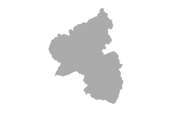
Rheinland-Pfalz (07) 6.178°/48.935° 8.513°/50.947°
Regionalschlüssel
070000000000
Koordinaten­system
EPSG 25832: ETRS89 / UTM Zone 32N

Verweise und Downloads

URL des Zugangs (1)

http://map1.naturschutz.rlp.de/service_lanis/mod_wms/wms_getmap.php?mapfile=group_gdide&service=WMS&version=1.1.1&Request=GetCapabilities

Downloads (1)

LANIS

Weitere Verweise (5)

Bruchbach-Otterbachniederung Information
Dienst "V Protected Landscape/seascape" (GetCapabilities)
IUCN Categories Information
Laacher See Information
Östliche Pfälzer Moorniederung Information

Übergeordnete Objekte (1)

Geodatendienst
IUCN
In Rheinland-Pfalz erfüllen die Natura 2000 Gebiete die IUCN Kategorie IV (Habitat Species management area) und 3 Naturschutzgebiete die IUCN Kategorie V (Protected Landscape/seascape). IUCN Protected Areas Categories System Ia Strict Nature Reserve Category Ia are strictly protected areas set aside to protect biodiversity and also possibly geological/geomorphical features, where human visitation, use and impacts are strictly controlled and limited to ensure protection of the conservation values. Such protected areas can serve as indispensable reference areas for scientific research and monitoring Ib Wilderness Area Category Ib protected areas are usually large unmodified or slightly modified areas, retaining their natural character and influence within permanent or significant human habitation, which are protected and managed so as to preserve their natural condition. II National Park Category II protected areas are large natural or near natural areas set aside to protect large-scale ecological processes, along with the complement of species and ecosystems characteristic of the area, which also provide a foundation for environmentally and culturally compatible, spiritual, scientific, educational, recreational, and visitor opportunities. III Natural Monument or Feature Category III protected areas are set aside to protect a specific natural monument, which can be a landform, sea mount, submarine cavern, geological feature such as a cave or even a living feature such as an ancient grove. They are generally quite small protected areas and often have high visitor value. IV Habitat/Species Management Area Category IV protected areas aim to protect particular species or habitats and management reflects this priority. Many Category IV protected areas will need regular, active interventions to address the requirements of particular species or to maintain habitats, but this is not a requirement of the category. V Protected Landscape/ Seascape A protected area where the interaction of people and nature over time has produced an area of distinct charcter with significant, ecological, biological, cultural and scenic value: and where safeguarding the integrity of this interaction is vital to protecting and sustaining the area and its associated nature conservation and other values. VI Protected area with sustainable use of natural resources Category VI protected areas conserve ecosystems and habitats together with associated cultural values and traditional natural resource management systems. They are generally large, with most of the area in a natural condition, where a proportion is under sustainable natural resource management and where low-level non-industrial use of natural resources compatible with nature conservation is seen as one of the main aims of the area
Identifikator des über­geordneten Metadaten­satzes

6035F651-0A68-4A57-9C49-1A42308C9E9E

Nutzung

Nutzungs­bedingun­gen

Open Data Commons Open Database License (ODbL)

Zugriffs­beschränkun­gen

no limitations to public access

Anwendungs­einschränkun­gen

keine

Kontakt

Point of Contact

Ministerium für Klimaschutz, Umwelt, Energie und Mobilität Abteilung 2 (MKUEM) - Naturschutz und nachhaltige Entwicklung Referat 22 (MKUEM) - Haushalt, IT und sonstige Querschnittsaufgaben der Naturschutzverwaltung

Postfach 31 60
D-55021 Mainz
Kaiser-Friedrich-Straße 1
D-55116 Mainz
Deutschland

poststelle@mkuem.rlp.de
(+49) 06131 16-2437
https://mkuem.rlp.de/de/ueber-uns/abteilungen-und-ihre-aufgaben/abteilung-2/referat-23/
Custodian

Ministerium für Klimaschutz, Umwelt, Energie und Mobilität Abteilung 2 (MKUEM) - Naturschutz und nachhaltige Entwicklung Referat 22 (MKUEM) - Haushalt, IT und sonstige Querschnittsaufgaben der Naturschutzverwaltung

Postfach 31 60
D-55021 Mainz
Kaiser-Friedrich-Straße 1
D-55116 Mainz
Deutschland

poststelle@mkuem.rlp.de
(+49) 06131 16-2437
https://mkuem.rlp.de/de/ueber-uns/abteilungen-und-ihre-aufgaben/abteilung-2/referat-23/

Fach­informationen

Informationen zum Datensatz

Klassifikation des Dienstes

Map access service (WMS, WMTS, API Maps etc.)

Art des Dienstes

View Service

Operation
Name der Operation Beschreibung der Operation Aufruf der Operation
GetCapabilities

http://map1.naturschutz.rlp.de/service_lanis/mod_wms/wms_getmap.php?mapfile=group_gdide&service=WMS&version=1.1.1&Request=GetCapabilities

Get­Ca­pa­bi­li­ties Do­ku­ment
Get­Ca­pa­bi­li­ties an­zei­gen
Kartenansicht öffnen

Zusatzinformationen

Kon­formi­tät
Spezifi­kation der Kon­formi­tät Spezifi­kations­datum Grad der Kon­formi­tät Geprüft mit
VERORDNUNG (EG) Nr. 976/2009 DER KOMMISSION vom 19. Oktober 2009 zur Durchführung der Richtlinie 2007/2/EG des Europäischen Parlaments und des Rates hinsichtlich der Netzdienste 20.10.2009

Schlag­worte

INSPIRE-Themen Area management/restriction/regulation zones and reporting units Habitats and biotopes Protected sites
Suchbegriffe Area Artenschutz Biologische Vielfalt Biotopschutz Eingriffsregelung Habitat inspireidentifiziert IUCN Landschaft Landschaftsbild Landschaftsschutz Management Naturschutz opendata Schutzgebiet Species Speziation Umwelt

Informationen zum Metadatensatz

Objekt-ID

A01AEA17-E4E7-409A-A39A-3C24BE3E540A

Aktualität der Metadaten

19.10.2022

Sprache Metadatensatz

Englisch

XML Dar­stellung
Metadaten als XML herunter­laden
Metadatenquelle
Rheinland-Pfalz
Ministerium für Klimaschutz, Umwelt, Energie und Mobilität Rheinland-Pfalz (MKUEM)

PortalU RLP
Ministerium für Klimaschutz, Umwelt, Energie und Mobilität
Hilfe Kontakt Inhaltsübersicht Impressum Datenschutz Barrierefreiheit
Nach oben

Hilfe